I'm reminded of Wendell Berry's essays on community. It's easy sometimes, going about your life on your property and in your house, to live on an island, separate from the people who live on the other side of the creek, lawn or wall. But whether or not we like the idea, we are not independent.
The aerial views of our farm point out very clearly that our home is part of a landscape of homes. The James River, Elk Creek and Arnold's Valley Road surround our property and, as the deed to our property will attest, physically delineate it. The higher you go, the less clear those boundaries become.
Without my help, you probably wouldn't recognize the borders of our farm. You'd notice clusters of homes -- our neighbors and us. A higher, broader view might see Natural Bridge Station, then our zip code 24579. If we'd gone higher, perhaps Rockbridge County, Virginia, the United States, North America, Earth, and beyond. An economist might call these macro and micro perspectives.
All of these are communities, in a sense. In the warmest view, our neighbors and us make a community. We know, or quickly learn, what happens in our neighborhood. Some of us interact almost daily, sharing talents, the bounties of our gardens, tools, carpools. Others choose to stay apart or to note our presence in limited ways -- waves as we walk or drive past, lawnmower and weed-whacker whines, the bangs of target practice.
Of course, we also relate in communities not based on geographies. For example, we belong to a community of farmers (if you define this term loosely enough) -- goat farmers, donkey farmers, organic farmers, tractor-less farmers, farmsteaders, etc. Musicians. Runners. Gardeners. Outdoor lovers. Writers. Raw milk users. Aerial views aren't very helpful here.
This morning, as I foraged for wineberries below Thunder Ridge, I came across this fellow:

No, I didn't. It's hard to tell from this aerial view, but that snail is about 3 feet off the ground. How did it get up to that leaf and why?
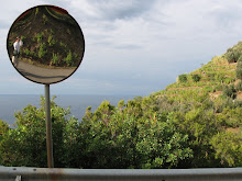
I realize this is stretching things a bit. Indulge me, please, and forgive me if need be. Aerial views show only a little bit of anything. We use them at great risk of oversimplifying. So, dear donjuan, know that I'm very skeptical of drones.
"You're droning," says Virginia.
Thanks for the shout out! You haven't posted in awhile; I'm assuming it's because of the flourishing fields and gardens.
ReplyDeleteScale issues are a hot topic in earth science research because although we can understand the tiniest pieces with relatively great certainty, it's not so easy to "add them up." So some people start from the top and work their way down--instead of studying a tiny pebble, let's look at the whole mountain! It's a reformulation of reductionistic vs. holistic thinking. The tricky part is bridging the gap between the two with a solid theory (expressed mathematically). So far in most cases we've come to discover that in many cases the tiniest parts are too important to ignore, but too numerous to account for! My research group relies heavily on statistical methods to "get around" the problem.
I guess it's kinda the same with zooming out from Elk River. You can see the moving parts from the sky and probably guess where a field will show up next, or where a bridge will appear in the future, but you'll never have a "complete" understanding without also shaking hands with the neighbors or spending a day in the garden.
Keep it up!